Quick Start
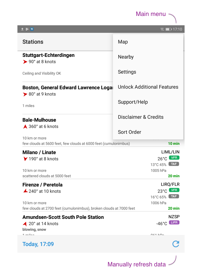
When the app starts for the first time, default airports will be shown. The button in the top right corner gives you access to most additional functions like:
- Map: shows map of all stations defined in your list. Tap on any airport pin to get station details.
- Nearby: provides a list all nearby stations. This list can’t be edited. Use the top left arrow button to get back to main list.
- Sort Order: offers various options (by ICAO, IATA, name, country, oder user-defined) to sort your list
The remaining items of the main menu provides access to various settings, further help, and the possibility to remove the ad banner at the bottom.
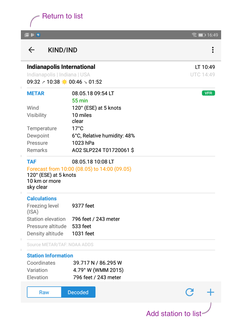
Adding stations to list: tap on the search button (top right, next to main menu button) and do a fulltext search. Tap on any station to get to the detail. To add it to your list, tap on the + button (right bottom corner) or tap on the main menu button and then use “add”.
Removing stations from list: when in detail station view either use the – button (right bottom corner) or tap on the main menu button and then use “delete”. When in list view you can swipe to the left or right in order to delete a station.
If sort order “user-defined” is used, station can be moved within the list by drag and drop.
Settings
The most important setting in the Format section are:
- Local Times: if enabled, all times in decoded METAR/TAF will be shown in the station’s local timezone. Otherwise UTC times are shown.
- Twilight: twilight times are shown in the following format: dawn ➚ sunrise ☀ sunset ➘ dusk. If switched off, sunrise ☀ sunset will be shown.
- Calculations: if enabled, an additional section will show up underneath TAF section. Depending on the available METAR data it’ll show: freezing level (based on ISA), density altitude, pressure altitude, and station elevation. Either temperature for windchill or heat index will be displayed automatically.
- World Magnetic Model (WMM): magnetic variation data is continuously changing and airport data might not be accurate anymore. The NOAA WMM allows calculation of magnetic variation for any point on the globe.
- Indicators: choose how and when different kind of indicators should be shown throughout the app.
To change the app language go to General settings. After setting the language, kill the app and start it again.
METAR/TAF
The METAR cell is interpreted as follows:
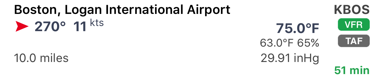
Line
| 1 | station name / ICAO/IATA identifier |
| 2 | wind direction and speed / wind gusts speed / temperature / flightrule indicator |
| 3 | weather description / dew point / relative humidity (%) |
| 4 | visibility / pressure (plus trend over the last 4 METARs) |
| 5 | most critical cloud coverage (OVC/BKN) and ceiling; age of data (in minutes) |
The flightrule condition icon indicates the current visibility and cloud ceiling either by ICAO or NOAA definition:
ICAO
| Visual Meterological Conditions | |
| Instrument Meterological Conditions Visibility < 5000m/3.1mi or BKN/OVC ceiling < 450m/1500ft |
NOAA
| Visual Flight Rules Ceiling greather than 3000 feet AGL and visibility greather than 5 miles | |
| Marginal Visual Flight Rules Ceiling between 1000 – 3000 feet AGL and/or visibility between 3 – 5 miles | |
| Instrument Flight Rules Ceiling between 500 – 1000 feet AGL and/or visibility between 1 – 3 miles | |
| Low Instrument Flight Rules Ceiling below 500 feet AGL and/or visibility less than 1 mile | |
| * AGL = above ground level |